Geological and Geophysical Investigation
Geological & Geophysical Investigation Services
At BENAN, we provide a comprehensive integrated approach of geological and geophysical investigations to characterize the subsurface conditions for engineering site evaluation, mineral exploration, groundwater assessment, and environmental studies. We combine advanced field techniques, modern survey technologies, and expert data interpretation to support exploration, engineering, environmental, and resource-related projects. Our services reduce geological uncertainty and deliver reliable, data-driven insights for informed decision-making.
Geological Investigation
Topographic Survey
- Conducting detailed surveys to map terrain features, elevation variations, and landforms.
- Providing essential data for infrastructure planning, site selection, and flood risk assessment.
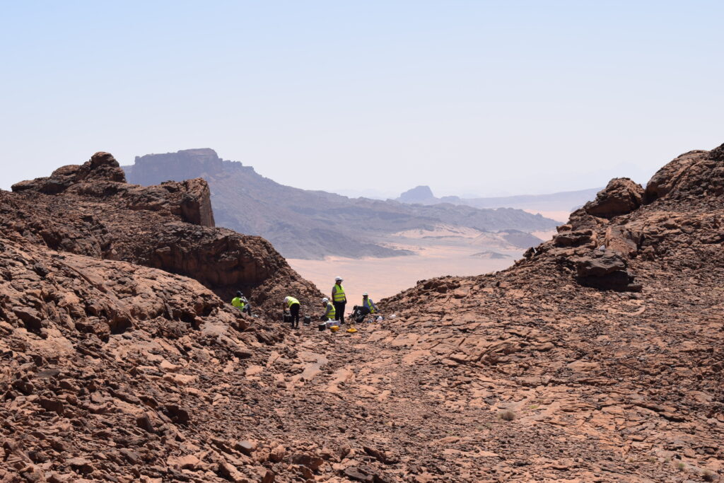
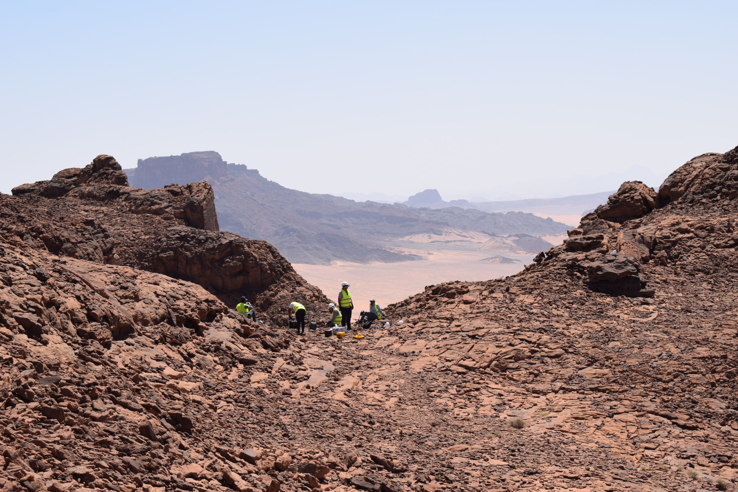
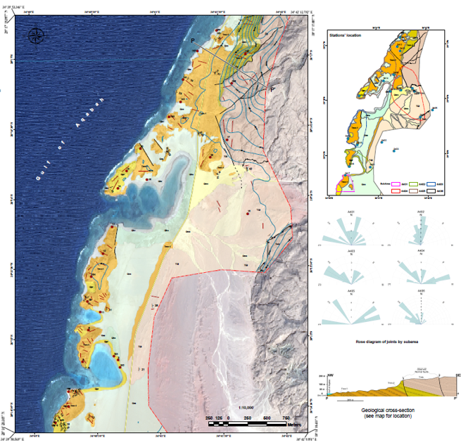
Detailed Geological Mapping (Stratigraphic & Structural Analysis)
- Mapping geological formations, stratigraphy (layered rock sequences), and structural features (folds, faults, joints).
- Understanding geological processes and their implications for engineering andenvironmental projects
Petrophysics Analysis
- Analyzing physical properties of rocks (e.g., porosity, permeability, acoustic properties) to evaluate reservoir characteristics and groundwater flow.
Core Analysis
- Studying geological cores obtained from boreholes to understand subsurface geology, sedimentology, and stratigraphy.
- Extracting valuable information for resource exploration, mining, and environmental studies.
3D Geological Modeling
- Creating three-dimensional models of subsurface geology using geological data, borehole logs, and geophysical surveys.
- Visualizing geological structures and predicting geological hazards.
Geophysical Investigation Service
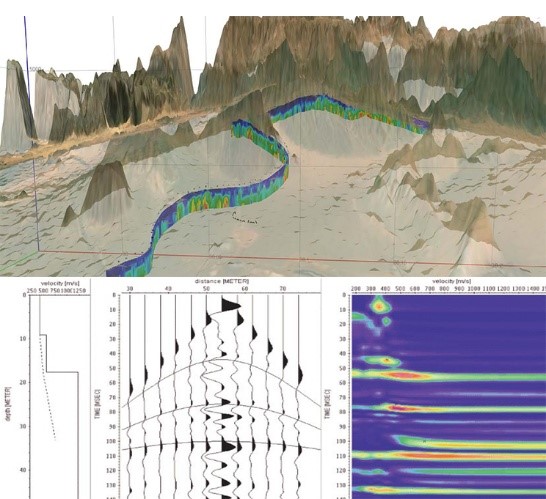
Seismic Method
- Reflection Seismology: Using controlled sources of energy (e.g., explosives, vibrators) and receivers (geophones) to image subsurface structures, such as geological layers, faults, and fluid reservoirs.
- Refraction Seismology: Analyzing the travel times of seismic waves to map subsurface velocity variations and infer geological properties, useful for determining bedrock depth and seismic velocity profiles.
Gravity and Magnetic Survey
- Gravity Survey: Measuring variations in gravitational attraction to map subsurface density contrasts, such as variations in rock types and structures.
- Magnetic Survey: Mapping variations in the Earth’s magnetic field caused by magnetic minerals to identify geological structures and potential mineral deposits.
Electrical Resistivity Tomography (ERT)
- Imaging subsurface electrical resistivity variations using multiple electrodes to detect geological features, groundwater tables, and assess soil contamination or foundation conditions.
Ground Penetrating Radar (GPR)
- Transmitting and receiving radar pulses to image subsurface features and structures, including buried utilities, archaeological artifacts, and geological layers.
Optical Televiewer Logging
- Conducting borehole imaging using a rotating optical probe to capture high- resolution images of borehole walls, revealing geological structures, fractures, and bedding planes.